#VETSVolunteerVoices aims to bring you the stories of our passionate VETS program volunteers from the field. Meet Ian Parfitt, a GIS Mapping Advisor who spent three months in Cambodia (January–April 2025) supporting organic agriculture and digital transformation with our local partner, AVSF Cambodia.
From the West Kootenays to Preah Vihear
When I came across the GIS Mapping Advisor opportunity with the VETS program, it felt like the perfect fit. After two decades as a GIS instructor and analyst in British Columbia—mostly in the rural West Kootenay region—I was ready to apply my skills in a new context. What drew me in was the opportunity to support agricultural cooperatives in another rural part of the world: Preah Vihear province, Cambodia.
This wasn’t my first experience working internationally—I had worked on wilderness mapping projects early in my career—but it was my first time volunteering overseas in this way. I’ve always loved travel and learning about new cultures, and this three-month placement was a great re-introduction to international work.
Building GIS Capacity Where It’s Needed Most
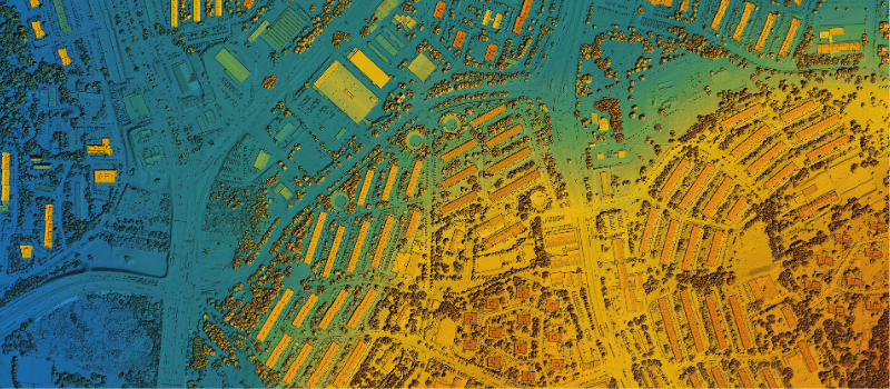
My placement focused on strengthening the geographic information system (GIS) and mapping capacity of PMUAC—a union of agricultural cooperatives supported by Agronomes et Vétérinaires Sans Frontières (AVSF) Cambodia. Together, AVSF and PMUAC are helping smallholder farmers in Preah Vihear province gain organic certification for crops like rice. As certification requirements grow more complex, the ability to produce detailed digital maps of farm locations, roads, and potential contamination risks has become increasingly vital.
With AVSF’s coordination, I led several GIS and GPS training sessions for the PMUAC team using QGIS—an open-source software that’s well-suited to both their technical needs and their budget. Each staff member had their own laptop with QGIS installed, and I developed Khmer-translated PowerPoint modules to guide us through GIS theory, practical exercises, and map-making. By the third day, we were out in the field using GPS units to collect data—an energizing shift from classroom to real-world application.
By the end of the training, PMUAC staff could transfer data from KoboToolbox (their mobile field data app) into QGIS, build custom maps, and use layout templates designed to be replicated for other cooperatives. With AVSF’s support, the team also made a strategic shift from an outdated ArcGIS license to QGIS—opening up new possibilities for long-term learning and collaboration with Cambodia’s broader network of GIS practitioners.
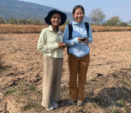 PHOTO: PMUAC staff using GPS units in the field.
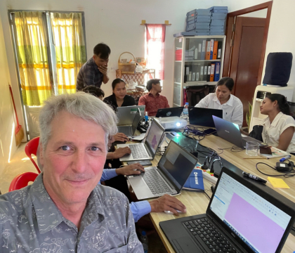 PHOTO: Ian leading QGIS training at the PMUAC Office.
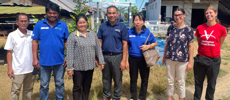
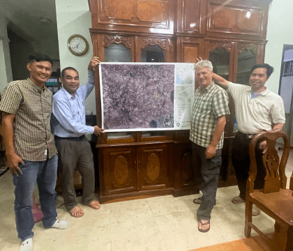 PHOTO: Presenting the AC02 map with PMUAC and AVSF.
A Day in Kuleaen: Mapping with the Community
One of the most rewarding experiences of my placement was working with Agricultural Cooperative 02 (AC02) in Kuleaen district. PMUAC wanted to create large-format maps that could be displayed and used locally. We selected AC02 because they already had partial field data. I worked with the team to refine a map template, then we hit the road to present it in person.
When we arrived at the AC office—a simple open-air hall with a roofed structure—the members hung a white sheet on the wall to serve as a projection screen. I introduced the project, and we spent the next couple of hours refining the map based on community feedback. They suggested adding points of interest like the health centre, administrative buildings, churches, and cassava fields. With their input, we were able to adjust the map on the spot, finalize a draft, and share a meal afterward in true Cambodian hospitality.
It was a moment of real collaboration—seeing people connect the digital world of GIS with their lived landscape, and getting excited about the results.
Learning Curves and Realities
Like any volunteer experience, there were challenges. Language was a constant hurdle, and I relied on bilingual staff and translated materials. Transportation to the rural PMUAC office—10 km outside of town—was another logistical puzzle.
The biggest curveball came in March, when newly updated organic certification regulations required several key staff members to attend last-minute training in Phnom Penh. This disrupted our original timeline and limited the amount of one-on-one coaching I could provide. Still, we were able to regroup in April and hold a comprehensive debrief session to reinforce learning.
GIS isn’t easy—it takes time to absorb—but the foundation is there. I encouraged PMUAC to assign one or two field officers as designated GIS leads so the knowledge doesn’t fade.
Insights on Sustainability and Impact
One key takeaway for me was the importance of pairing technical training with long-term support. PMUAC, like many small organizations, needs better systems for data storage and management. I recommended integrating digital training and data infrastructure into future grant proposals, and holding annual refreshers on GIS and data analysis.
There’s also significant potential for GIS across other areas of development. During my placement, another VWB volunteer, Elise Tessier, joined a training session I delivered at the AVSF head office in Phnom Penh. She immediately applied what she learned to develop study area maps for an AVSF-led epidemiological study in Battambang province. That kind of cross-program collaboration is exactly what the One Health approach is all about.
More Than Maps: Building Meaningful Connections
Beyond the maps and the training, some of my most meaningful moments were the quiet ones—sharing meals after workshops, celebrating a housewarming party with colleagues, or chatting with other NGO staff at PMUAC’s general assembly. Those moments made me feel like more than a visitor. They reminded me that while technology has a role to play, real progress is built on relationships, trust, and community.
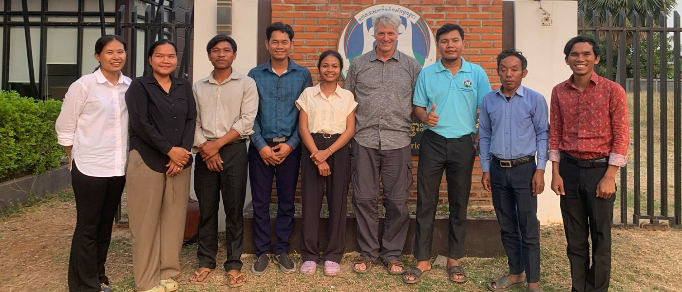 PMUAC team and Ian Parfitt (4th from right) during QGIS training in Preah Vihear, March 2025.
Advice for Future Volunteers
For future VETS volunteers—especially those in technical advisory roles—my advice is simple: start slow, listen closely, and adapt as you go. It’s important to meet people where they’re at while also gently encouraging them to think ahead. Training is most effective when it’s seen as valuable, not overwhelming.
This placement reaffirmed my belief in the power of spatial data for grassroots development—and it gave me a renewed appreciation for the people behind the maps.
VETS is an 8-year initiative (2020-2028) to improve the economic and social well-being of marginalized people, particularly women and girls, in 6 countries across Africa and Asia. In collaboration with local partners, the program is implemented through 190 Canadian volunteers on international assignment and is generously funded by Global Affairs Canada. Learn more.